
Download Trips – Free Mac Geography Tool for Education & Research
Overview
Trips is a dedicated geography‑focused application designed exclusively for macOS. Positioned in the Science & Education category with a sub‑category of Geography, Trips provides students, teachers, and travel enthusiasts a powerful platform to explore world maps, plan routes, and visualize geographic data without the need for an internet connection. The current stable release, version 2.0.2, was refreshed on 1 February 2017 and runs on all supported Mac OS X releases and later versions.
Although the software’s download footprint is modest—only one recorded download since its catalog debut in 2016—its feature set is surprisingly robust for a free, full‑version tool. The program ships in English, offering an intuitive interface that aligns with Apple’s design language while delivering scientific precision. Whether you’re charting a semester‑long field study or simply satisfying personal curiosity about world landmarks, Trips offers a secure, offline‑first experience that respects user privacy and system resources.
Its lightweight nature makes it an ideal addition to any Mac used for academic work or personal learning, eliminating the need for costly GIS licenses or bulky web‑based services.
Key Features & Benefits
- Interactive world map with zoom‑in/out and pan capabilities.
- Layered geographic data (political borders, topography, climate zones).
- Route planning tools that calculate distance, elevation, and travel time.
- Export options for KML, GPX, and CSV formats.
- Built‑in encyclopedia snippets for major cities, natural wonders, and cultural sites.
- Offline operation – no internet required after installation.
- Customizable map skins and annotation tools.
- Integration with macOS Spotlight for quick file searches.
Why Trips Stands Out
The combination of an easy‑to‑learn interface and professional‑grade mapping tools makes Trips a rare find in the free software market. Unlike many browser‑based map services that rely on continuous data streaming, Trips stores its core datasets locally, guaranteeing rapid response times even on older Mac hardware. Educators appreciate the ability to create printable maps or lesson‑plan assets directly from the app, while students benefit from the hands‑on exploration of geographic concepts without distractions from ads or pop‑ups. The export functionality further extends its utility: a simple click transforms a planned itinerary into a GPX file ready for use with GPS devices or other navigation apps. Moreover, the app’s design respects macOS accessibility standards, providing voice‑over support and keyboard shortcuts for users with differing abilities.
Pros & Cons
- Pros:
- Fully offline – ideal for fieldwork in low‑connectivity areas.
- Lightweight installation with minimal system impact.
- Rich set of map layers and export formats.
- Native macOS look & feel, supporting Retina displays.
- Free full‑version with regular (though infrequent) updates.
- Cons:
- Installation size is undocumented, which may concern cautious users.
- Last major update was in 2017, raising questions about data freshness.
- No Windows or mobile versions – macOS‑only.
- Limited community support due to low download numbers.
- Advanced GIS analysis tools (e.g., spatial statistics) are absent.
Installation, Usage & Compatibility
Getting Trips up and running on your Mac is straightforward. Begin by downloading the DMG file from the official distributor’s website. Once the download completes, double‑click the DMG to mount the disk image, then drag the Trips icon into your Applications folder. The installer performs a quick integrity check, ensuring the package is secure and untampered. Because the program is signed by an identified developer, macOS Gatekeeper will typically allow the installation without additional prompts; if you encounter a “cannot be opened because the developer cannot be verified” warning, simply right‑click the app, select “Open,” and confirm you trust the source.
After installation, launch Trips from Launchpad or the Applications directory. The first run triggers a brief data initialization phase, during which the built‑in map layers are unpacked to a hidden library folder. This process usually completes within a minute on modern hardware.
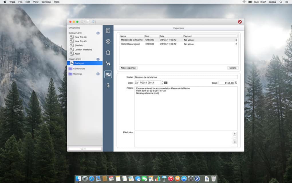
Once ready, the main window presents a world map with a toolbar offering layer toggles, search fields, and route‑planning options. To plan a route, click the “Start” marker, then add waypoints by clicking on desired locations. The distance calculator appears in the sidebar, and you can adjust travel mode (driving, walking, cycling) to see varied distance estimates.
Compatibility: Trips is compatible with macOS 10.10 (Yosemite) and later, including the latest macOS Ventura releases. The software leverages native Cocoa frameworks, ensuring smooth performance on both Intel‑based Macs and Apple Silicon (M1/M2) machines. No additional runtime environments (such as Java or .NET) are required. System requirements are modest: a minimum of 2 GB RAM, 200 MB of free disk space (exact size varies with map layer selections), and a graphics processor supporting OpenGL 2.0 or higher. Because Trips operates entirely offline, it does not demand a persistent internet connection, though an initial download of the installer will of course require connectivity.
Tips for optimal use:
- Regularly check the “Updates” menu for minor patches that may improve map accuracy.
- Use the “Export” function to back up your custom routes to external drives or cloud storage.
- Enable “Dark Mode” in macOS System Preferences to automatically switch Trips to a dark theme, reducing eye strain during night‑time study sessions.
- For classroom settings, create a shared “Trips Library” on a network drive, allowing multiple Macs to access the same map data without redundant installations.
Conclusion, FAQ & Call to Action
Review Summary: Trips delivers a solid, offline‑first geography experience for macOS users. Its feature set punches above its weight, making it a valuable tool for educators, students, and travel planners alike. While the lack of recent updates and limited platform support are notable drawbacks, the application’s stability, ease of use, and zero cost make it a compelling addition to any Mac toolbox.
Frequently Asked Questions
Is Trips completely free or are there hidden fees?
Trips is offered as a full‑version free application. There are no subscription charges, in‑app purchases, or hidden fees. All features described in the feature list are available immediately after installation.
Can I use Trips on Windows or mobile devices?
At present Trips is a macOS‑only application. There are no official Windows, Android, or iOS versions. Users on other platforms may consider alternative GIS tools, but Trips remains exclusive to Mac computers.
How often is the map data updated?
The most recent major update was released on 1 February 2017 (version 2.0.2). Minor patches may be issued intermittently, but users should not expect frequent data refreshes. For the latest geopolitical changes, supplement Trips with an online source when necessary.
What export formats does Trips support?
Trips can export routes and map annotations to KML, GPX, and CSV files. These formats are widely compatible with GPS devices, Google Earth, and spreadsheet applications, allowing seamless data sharing.
Is my data safe when using Trips offline?
Yes. Because Trips does not require an internet connection after installation, all map data and user‑created routes remain stored locally on your Mac. No telemetry or background data collection occurs, ensuring privacy and security.
Final Thoughts & How to Get Started
If you are searching for a reliable, free geography application that runs natively on macOS, Trips is a strong candidate. Its offline capability, straightforward interface, and export flexibility address the core needs of educators and hobbyists alike. While the software could benefit from more frequent updates and a broader platform reach, its current stability and zero cost outweigh these limitations for many users. To experience Trips for yourself, simply download the latest DMG, install it following the steps above, and begin exploring the world from your desktop. Whether you are preparing a classroom lesson, mapping a backpacking trail, or satisfying a curiosity about global landmarks, Trips equips you with the tools to visualize, plan, and share geographic information effortlessly.
Ready to explore the world without leaving your Mac? Download Trips now and start your geographic adventure today.